
ECOLOGICAL MONITORING OF SOIL FERTILITY PARAMETERS IN SOME INTRABASIN AREAS OF SHAKDAGSKY NATIONAL PARK
ECOLOGICAL MONITORING OF SOIL FERTILITY PARAMETERS IN SOME INTRABASIN AREAS OF SHAKDAGSKY NATIONAL PARK

Abstract
This work is dedicated to the issue of ecological monitoring of soil fertility. It looks at changes in the soil fertility parameters of certain sub-basin areas of the Shahdag National Park that occurred over 60–70 years. It has been found that during this time, many fertility parameters have worsened under the influence of human and natural factors. As a result of deforestation, non-compliance with livestock grazing standards, and the development of forest soils suitable for agricultural production due to relief conditions, erosion processes have increased, partial steppe formation in forest soils has occurred, leading to the replacement of forest vegetation with steppe formations and changes in the water regime, and the stocks of humus and total nitrogen have decreased. Accordingly, other important soil fertility indicators have also changed.
1. Introduction
In modern times, in the context of rapid industrialization and intensive agriculture on our planet, protecting the environment, including soil cover, is very important not only worldwide but also in Azerbaijan. Thoughtless human impacts and the disruption of natural ecological balance, degradation of agricultural and natural soils, and other unwanted environmental problems receive a lot of attention in our country. Undoubtedly, the sustainable socio-economic development of the Republic of Azerbaijan, as well as the material well-being and health of its population, largely depend on preventing the negative consequences that these environmental problems have caused or could cause in our country. Regarding environmental protection, Azerbaijan's accession to a number of international conventions (such as the UN Framework Convention on Climate Change in 1995, the Kyoto Protocol in 1997, the Convention on Environmental Impact Assessment in a Transboundary Context in 1999, the International Convention on Long-range Transboundary Air Pollution in 2002, etc.), as well as the laws, regulations, and other legal documents adopted in the republic, give people great hope for solving these problems
, . Just like everywhere else in the world, in our country, environmental protection, especially the preservation of the soil cover, is one of the most important issues. So, over the last hundred years in Azerbaijan, intensive use of land resources, expansion of settlements, the establishment of collector-drainage networks, and irregular and excessive grazing of livestock on pastures, among other human activities, have led to both a quantitative and qualitative deterioration of the soil cover and its fertility. As a result, soil erosion, salinization, alkalization, and other degradation processes have increased. This, in turn, has highlighted the importance of protecting soil cover in both natural and agro-ecosystems among other conservation measures. The reason for this is that most regions of our republic face soil problems to some extent. While other environmental issues within our borders (air pollution, the problem of radionuclides, the conservation of rare plant and animal species, etc.) are of a regional or local nature, the ecological problems of soil resources go beyond regional and local levels and have become national issues , .From our point of view, soil environmental monitoring is especially important right now. After all, while there are plenty of points to check the state of the atmosphere, surface, and sea waters, there are absolutely not enough monitoring points for soil conditions and pollution. Of course, the soil cover is a less dynamic system compared to the air and water bodies, so you don't need to sample it as often. Still, the vital ecological role of soils in the biosphere and human life makes it necessary to set up special soil monitoring as part of the overall monitoring of land and the environment. Soil cover is crucial for providing humanity with food and serves as a natural base for human settlements. The properties of soil and the chemical and biochemical processes occurring within it determine the purity of the air, as well as surface and groundwater. With the intensification of agriculture and industrial development, the soil cover experiences significant, and often irreversible, changes. Poorly thought-out human activities and disruptions to the natural ecological balance can lead to the mineralization of humus in soils, increased acidity or alkalinity, greater salt accumulation, and the development of restorative processes, which overall sharply worsen soil properties and sometimes lead to their complete degradation
, .In Azerbaijan, environmental monitoring of soils is very important for the reasons mentioned above. The first studies on soil environmental monitoring in our country were carried out by G.Sh. Mamedov
, . The work in this area was continued by S.Z. Mamedova, G.M. Ahmedova, and others , .2. Objects and methods of research
One of the most important issues in organizing ecological monitoring of soil is the selection of observation areas. The main principle of soil-ecological monitoring is to understand soil as a component of the biosphere that has functional and structural properties. From this perspective, soil cover can also be seen as a 'system of contours' that constantly exchanges matter and energy with each other.
Monitoring this exchange or any kind of variation in a place and figuring out its causes is associated with significant challenges. In this regard, river basins, that is, the areas that collect river water, can be considered favorable units for observation or tracking any dynamic processes.
In our opinion, dividing river basins into natural-ecological areas — watershed, transit, and accumulative zones — the fact that these areas are enclosed and separated from each other by natural divides (watershed lines), and the clear direction of matter and energy flow within the basin (from the watershed area to the accumulative area) are factors that enhance the accuracy of observations.
Taking the above into account, ecological monitoring of the land has been carried out in the separate river basins of Shahdag National Park (Fig.1.).
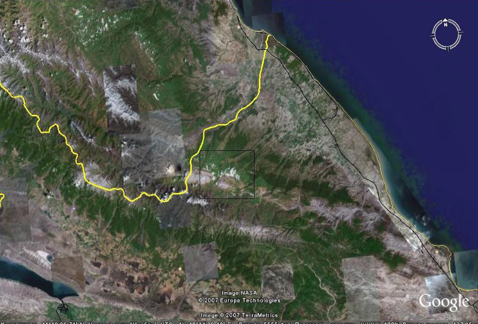
The image obtained using the Google Earth system is a satellite shot of the explored area inside the black rectangle
3. Results and their discussion
For our study, we chose the areas of river basins flowing on the northeastern slope of the Greater Caucasus—Gusarchay, Gudialchay, and Garachay. The catchment area of Gusar-chay is 69,400 hectares, Gudial-chay is 79,900 hectares, and Gara-chay is 41,700 hectares.
During the study, we used the 'basin method' because the basin area most fully meets the requirements for monitoring and has several advantages over other territorial units, namely clearly defined boundaries, unidirectional flow of matter and energy, and similar basin structures at all scales. In Azerbaijan, this method was first applied during soil studies by G.Sh. Mamedov
, .Chemical analyses were conducted using standard methods: humus — by wet oxidation using the I.V. Tyurin method; total nitrogen — by Kjeldahl; total phosphorus—using a mixture of ammonium oxalate and bicarbonate according to A.M. Meshcheryakov; absorbed bases — by D.V. Ivanov; pH of the aqueous suspension — by the potentiometric method.
During land monitoring, it's important to check the reliability of the fertility indicators that characterize the soil using mathematical and statistical methods. This is because the accuracy of the evaluation criteria is very important for predicting both the current state of the land cover and any potential future changes. So all the collected data were mathematically processed using the established methodology (Tab.1).
The results we got were compared with those known from studies done 60-70 years ago (materials from the Institute of Soil Science and Agrochemistry of the Azerbaijan National Academy of Sciences and the G.A. Aliyev Institute of Geography)
, , . The research was conducted over a ten-year period from 2016 to 2026. The final stage of fieldwork and laboratory analyses was completed in May 2026 .Over a number of years, we conducted studies on monitoring soil fertility in some sub-basin areas of Shahdag National Park (Fig. 2; Fig. 3; Fig. 4). In the Gusarchay River basin, research was carried out on mountain-meadow soddy soils, in the Gudialchay River basin on mountain-forest brown soils, and in the Garachay River basin on mountain-forest cinnamonic soils. This way, the main zonal soil types were covered, which allows us to clearly see the changes that have occurred over half a century. As a result, a deterioration in some soil fertility parameters was identified, which is reflected in the table below (Tab. 2).
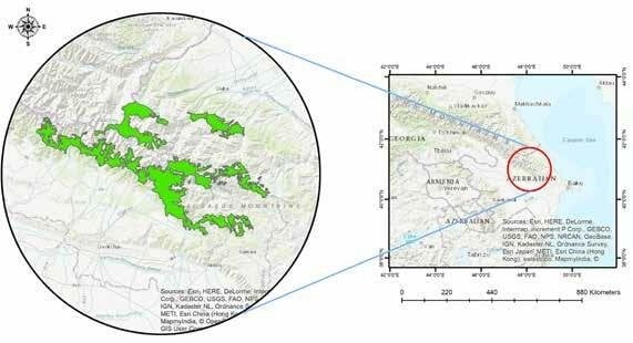
The location of Shahdagh National Park
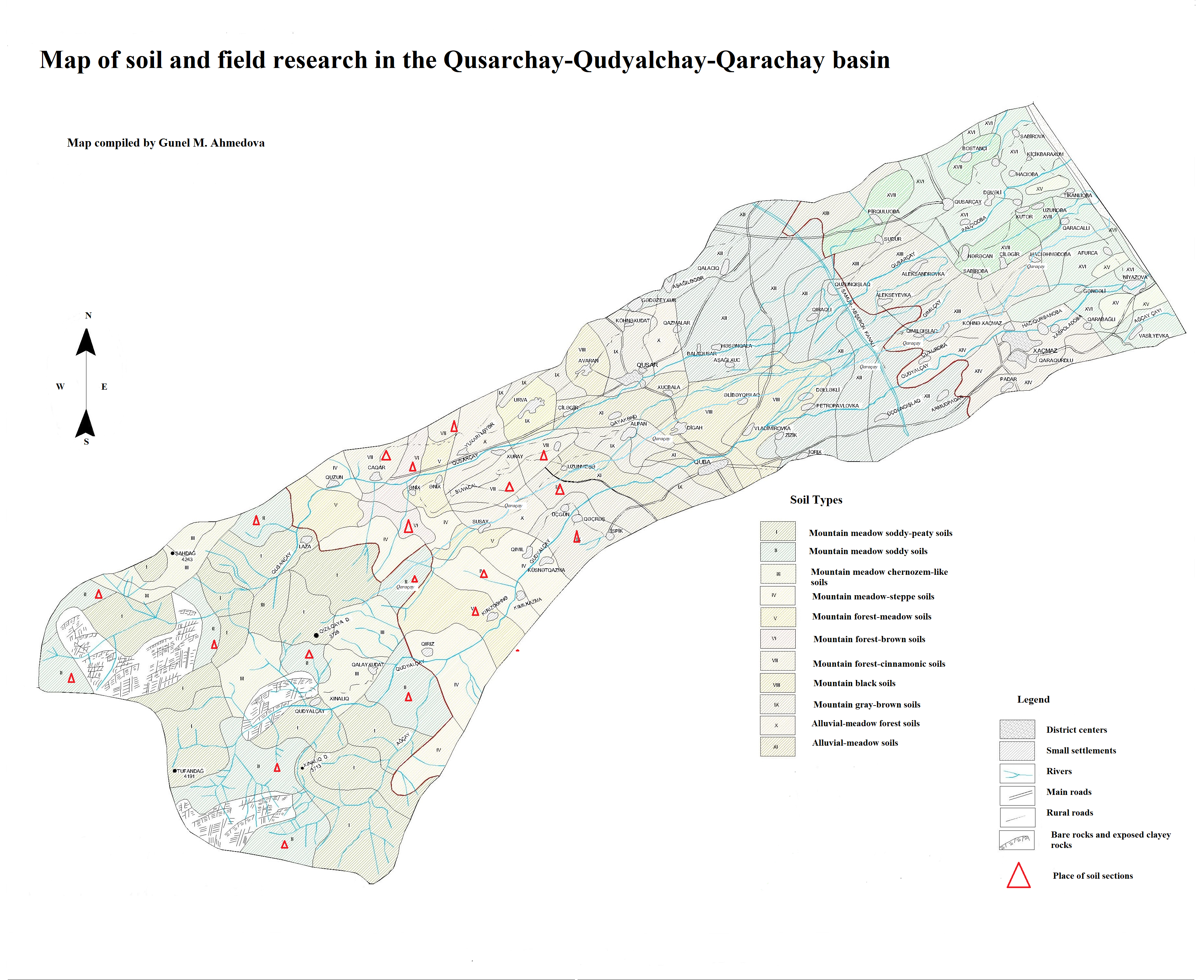
Map of soil and field research in the Qusarchay-Qudyalchay-Qarachay basin
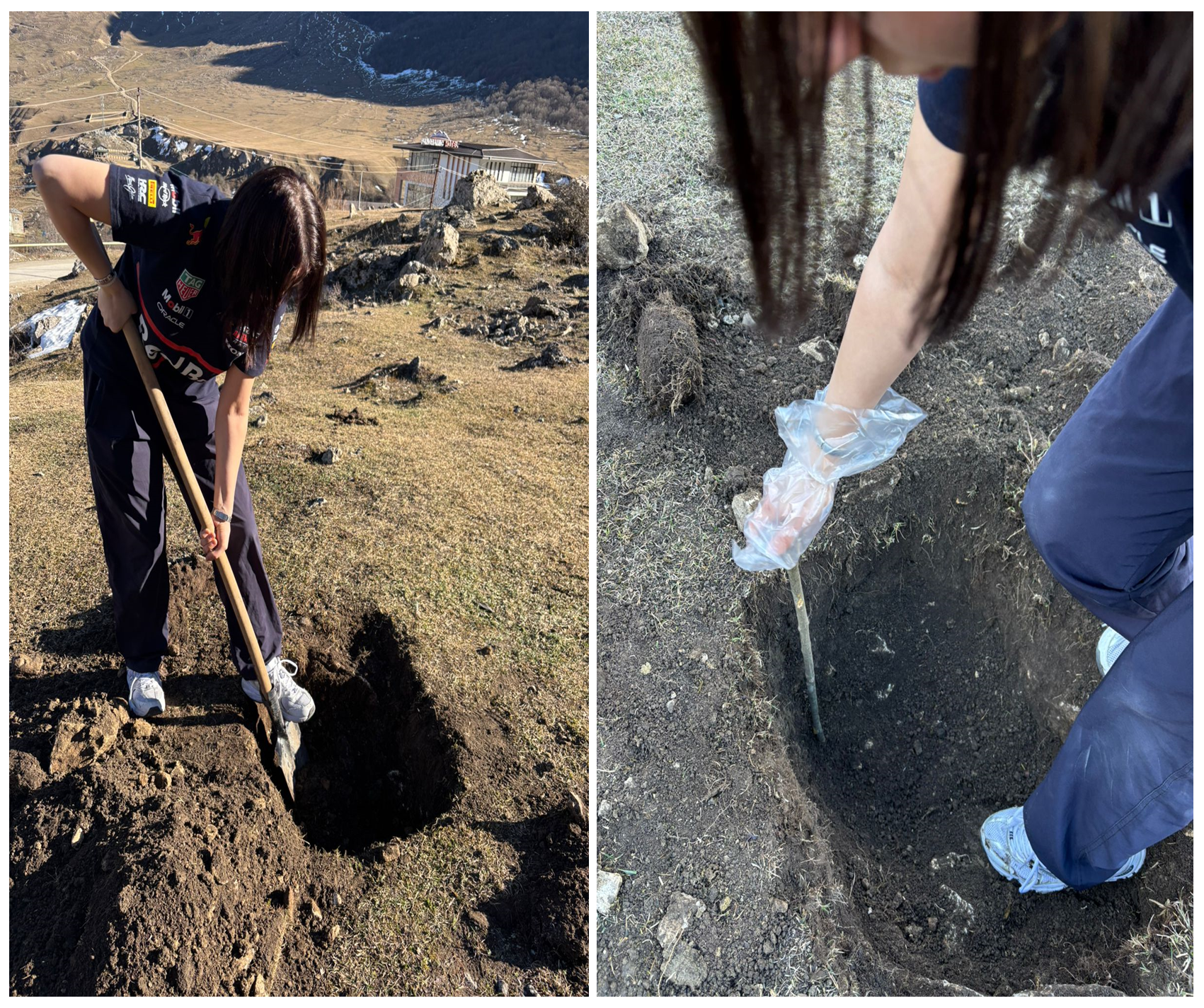
Fieldwork in some sub-basin areas of Shahdag National Park
Results of the mathematical analysis of the fertility indicators of Shahdag National Park soils
Indicators | Depth, cm | Medium price value М | Mean error, м | Mean square extension, s | Accuracy indicator P, % | Coefficient of variation C | Reliability level, t | Number of repetitions | |
taken | required | ||||||||
Mountain meadow soddy soils | |||||||||
Humus, % | 0-20 | 4,48 | 0,36 | 0,72 | 8,03 | 16,05 | 12,46 | 4,60 | 4 |
0-50 | 3,19 | 0,20 | 0,39 | 6,11 | 12,22 | 16,37 | 4,60 | 4 | |
0-100 | 1,97 | 0,10 | 0,21 | 5,20 | 10,41 | 19,22 | 4,60 | 4 | |
Nitrogen, % | 0-20 | 0,31 | 0,04 | 0,07 | 11,94 | 23,55 | 8,38 | 4,60 | 4 |
0-50 | 0,22 | 0,02 | 0,04 | 7,96 | 15,91 | 12,57 | 4,60 | 4 | |
Phosphorus, % | 0-20 | 0,31 | 0,01 | 0,03 | 4,29 | 8,55 | 23,40 | 4,60 | 4 |
0-50 | 0,22 | 0,02 | 0,03 | 7,27 | 14,55 | 13,75 | 4,60 | 4 | |
Potassium, % | 0-20 | 3,26 | 0,22 | 0,45 | 6,86 | 13,71 | 14,59 | 4,60 | 4 |
0-50 | 3,32 | 0,12 | 0,23 | 3,56 | 6,93 | 28,87 | 4,60 | 4 | |
ESP, meq /100 g of soil | 0-20 | 32,18 | 2,25 | 4,51 | 7.00 | 14,01 | 14,28 | 4,60 | 4 |
0-50 | 27,37 | 2,30 | 4,59 | 8,39 | 16,77 | 11,92 | 4,60 | 4 | |
Mountain-forest browns soils | |||||||||
Humus, % | 0-20 | 3,88 | 0,03 | 0,06 | 0,83 | 1,65 | 121,25 | 4,60 | 4 |
0-50 | 3,24 | 0,06 | 0,12 | 1,82 | 3,61 | 54,92 | 4,60 | 4 | |
0-100 | 2,12 | 0,09 | 0,18 | 4,34 | 8,68 | 23,04 | 4,60 | 4 | |
Nitrogen, % | 0-20 | 0,28 | 0,003 | 0,006 | 1,04 | 2,07 | 48,28 | 4,60 | 4 |
0-50 | 0,24 | 0,006 | 0,012 | 2,50 | 5,00 | 40,0 | 4,60 | 4 | |
Phosphorus, % | 0-20 | 0,29 | 0,01 | 0,02 | 3,62 | 7,24 | 27,62 | 4,60 | 4 |
0-50 | 0,24 | 0,02 | 0,04 | 7,50 | 15,00 | 13.33 | 4,60 | 4 | |
Potassium, % | 0-20 | 3,52 | 0,11 | 0,22 | 3,08 | 6,17 | 32,44 | 4,60 | 4 |
0-50 | 3,57 | 0,05 | 0,09 | 1,26 | 2,52 | 79,33 | 4,60 | 4 | |
ESP, meq/100 g of soil | 0-20 | 37,43 | 2,14 | 4,28 | 5,71 | 11,42 | 17,51 | 4,60 | 4 |
0-50 | 35,06 | 1,65 | 3,29 | 4,70 | 9,39 | 21,30 | 4,60 | 4 | |
Mountain forest cinnamonic soils | |||||||||
Humus, % | 0-20 | 3,32 | 0,09 | 0,04 | 0,56 | 1,13 | 177,54 | 4,60 | 4 |
0-50 | 2,71 | 0,13 | 0,25 | 4,68 | 9,36 | 21,37 | 4,60 | 4 | |
0-100 | 1,82 | 0,10 | 0,19 | 5,29 | 10,57 | 18,92 | 4,60 | 4 | |
Nitrogen, % | 0-20 | 0,24 | 0,003 | 0,006 | 1,21 | 2,42 | 82,76 | 4,60 | 4 |
0-50 | 0,20 | 0,01 | 0,03 | 6,45 | 12,9 | 15,50 | 4,60 | 4 | |
Phosphorus, % | 0-20 | 0,26 | 0,007 | 0,014 | 2,69 | 5,39 | 37,14 | 4,60 | 4 |
0-50 | 0,23 | 0,006 | 0,012 | 2,61 | 5,22 | 38,33 | 4,60 | 4 | |
Potassium, % | 0-20 | 3,02 | 0,18 | 0,36 | 5,89 | 11,76 | 16,97 | 4,60 | 4 |
0-50 | 3,28 | 0,08 | 0,17 | 2,56 | 5,11 | 39,05 | 4,60 | 4 | |
ESP, meq/100 g of soil | 0-20 | 30,93 | 1,24 | 2,49 | 4,02 | 8,04 | 24,86 | 4,60 | 4 |
0-50 | 30,87 | 0,89 | 1,78 | 2,88 | 5,77 | 34,69 | 4,60 | 4 | |
Changes in soil fertility parameters across the studied areas
1957–2026; all differences indicate an absolute change between the baseline (1957–1960) and the recent evaluation period (2016–2026). Negative values denote a decline in the respective parameter, while positive values indicate an increase
Soil Fertility Parameters
| Depth (cm) | Gusarchay | Gudialchay | Garachay | ||||||
Mountain-meadow soddy soils | Mountain-forest browns soils | Mountain forest cinnamonic soils | ||||||||
1957-1960 | 2016-2026 | Diffe-rence | 1957-1960 | 2016-2026 | Diffe-rence | 1957-1960 | 2016-2026 | Diffe-rence | ||
Humus content, % | 0-50 | 4.74 | 4.42 | -0.32 | 3.72 | 2.85 | -0.87 | 4.20 | 3.15 | -0.95 |
Humus reserve, t/ha
| 0-20 | 119 | 88 | -31 | 114 | 83 | -31 | 115 | 77 | -38 |
0-50 | 247 | 184 | -63 | 208 | 181 | -27 | 223 | 156 | -67 | |
0-100 | 375 | 273 | -102 | 297 | 279 | -18 | 317 | 228 | -89 | |
Crude nitrogen, % | 0-50 | 0.34 | 0.30 | -0.04 | 0.29 | 0.23 | -0.06 | 0.30 | 0.25 | -0.05 |
Gross phosphorus, % | 0-50 | 0.31 | 0.28 | -0.03 | 0.26 | 0.22 | -0.04 | 0.24 | 0.18 | -0.06 |
pH (aqueous suspension) | 0-50 | 6.10 | 6.28 | +0.18 | 6.50 | 6.82 | +0.32 | 6.67 | 6.89 | +0.22 |
Absorbed bases, mg-equiv/100g soil | 0-50 | 38.50 | 35.13 | -3.37 | 37.66 | 35.30 | -2.36 | 42.37 | 38.90 | -3.47 |
So, the content of a key indicator for soil fertility — humus — has noticeably decreased. Research shows that 60–70 years ago, in the mountain-meadow soddy soils of the Gusarchai River basin, the humus content in the 0-50 cm layer was 4.74%, but now it has decreased by 0.32% and is 4.42%. These changes are especially noticeable when looking at the humus stock. For example, in the 0–100 cm layer, the humus stock used to be 375 t/ha, but now it has decreased by 27.2% to 273 t/ha. Nitrogen and phosphorus content has also decreased: by 0.04% and 0.03%, respectively, in the 0–50 cm layer. The pH of the water extract has slightly increased from 6.1 to 6.28. The observed increase in the pH of the water suspension in the soils of the Gusarachay River basin (from 6.10 to 6.28) indicates processes of gradual alkalization of the soil cover. This trend is most likely caused by increased human activity, such as deforestation and excessive grazing pressure. The removal of topsoil and erosional degradation of the soil profile contribute to the exposure of underlying carbonate rocks, which triggers carbonation processes. The sum of exchangeable bases is currently 35.13 meq/100 g of soil, which is 8.75% lower than in previous years.
In the mountain-forest-brown soils of the Gudialchay River basin, the humus reserves in the 0–100 cm layer previously averaged 297 t/ha, but now this figure has decreased by 6% and is 279 t/ha. The amount of total nitrogen has also dropped: from 0.29% in the past to 0.23% now. The same goes for the sum of exchangeable bases: the value changed from 37.66 to 35.30 mg–eq/100 g of soil. If the pH of the water suspension averaged 6.5 before, it has now risen to 6.82.
Similar changes also occurred in the fertility parameters of mountain forest cinnamonic soils. In the mountain forest cinnamonic soils of the Garachay River basin, humus reserves used to be 317 t/ha, but nowadays they've dropped to 228 t/ha, which is about an average decrease of 28%. The content of total nitrogen has also gone down compared to the past, on average by 0.05 (from 0.30 to 0.25%). The reaction of the soil solution has also shifted a bit towards alkalinity, from 6.67 to 6.89. These changes were likely caused by a slight increase in hydrolytically alkaline salts and a rise in climate aridity.
4. Conclusion
It is clear that the fertility parameters of the studied areas have worsened, primarily due to human activities. The correlation analysis conducted between indicators of human impact (livestock grazing density and the extent of forest land clearing) and humus deficit in the studied basins showed a strong negative relationship (r = -0.82…-0.89). It was found that a reduction in organic matter reserves by 0.32–0.95% is directly caused by increased humus mineralization and erosion runoff when sod is destroyed by overgrazing. As a result of deforestation, failure to observe livestock grazing norms, and the development of forest soils suitable for agriculture based on terrain conditions, erosion processes have increased, partial steppe-like conditions have appeared in forest soils, leading to forest vegetation being replaced by steppe formations and changes in the water regime, with a decrease in humus and total nitrogen reserves. Consequently, other important soil fertility indicators have also changed. To prevent the negative effects of soil fertility decline, it is necessary to protect and improve the used soils by all means, paying special attention to forest conservation and restoration. As for the soils of summer pastures, the main thing is to follow livestock grazing norms (no more than 2–8 heads of small cattle), and in areas where the plant and soil cover is seriously damaged, completely ban grazing for a certain period (for 2–3 years) and plant turf-forming plants in those areas until the vegetation and soil cover is fully restored.